Tuesday, December 30, 2008

Guaymas and the Pearl Factory

Today we took a road trip with some of our new found friends. We were all going to Guaymas. Guaymas is a large city in Mexico. It took us about 3 hours to travel the back roads to the city from Kino Bay. Clarey and Lynn road with us as we followed Suzanne and Len and Pat, Bill and Kelly. They were taking Kelly back to the airport that afternoon, so it was a good time to take a little detour and see the sights.

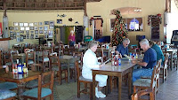
Our main goal was to see the the Perlas Del Mar de Cortez or the pearl factory along the Sea of Cortez. First, it was lunchtime and we found a very popular Mexican restaurant just within the city limits of Guaymas. It was an open sided structure with a thatched roof. Peg and I had shrimp that were cut into a circular pattern and then wrapped with bacon. It was great! Of course we had chips and salsa and guacamole! Since the lunch was taking quite a while, the restaurant owner said he was going to give us crab tostados, on the house, so we can munch on something while we waited. That was the least favorite thing we ate there.
After lunch, we drove across the city to the pearl factory. As you can see, the factory sat up on the side of a hill right on the water. It was a very modern building. We heard a talk on how the pearls are cultivated by the workers when they are babies. This picture shows the workers looking for these minute oysters and removing them from the nets.

The color of the oyster shell determines the color of the pearl. There are two different processes, one to get a round pearl and
one to get a rounded front and flat backed pearl. It takes less than a minute to implant the pearl with a plastic bead and put them in a retaining net so they can grow and mature. It takes about four years and a great amount of care to get a full sized pearl. The bouys you see here are hooked to the nets that hold the inseminated pearls. This factory is known world wide. Of course Peg had to get a "sample" of their wares! A beautiful pearl for in a sterling setting for a necklace.

Next, Peg and I and Clarey and Lynn went to a local hotel. Lynn had been here before and really liked the grounds and wanted to show them to us. We ended up at the Hotel, Playa DeCortez. It too was on the water across the bay from the pearl factory. We walked the grounds and enjoyed talking to a few of the guests there.

From there we headed to a very popular mall in Guaymas and then the three hours drive back to Kino Bay. It was a long day, but it was nice to see a little more of Mexico.

Thursday, December 25, 2008

Feliz Navidad!

Hola and Feliz Navidad from Kino Bay, Mexico. What a beautiful day with temperatures in the 70's and little wind. Yes, I was in the Christmas spirit!! We turned the TV on in the morning and actually had a picture. We watched two different Christmas Parades as Peg made a pumpkin pie for the Christmas Dinner that would happen at 3 pm here in the resort. The picture to the right is one of the walkways to the beach.

Believe it or not, Peg and Donna went clamming a few days ago and ended up with about 8 dozen clams!! They were small, but boy were they good. We stuffed ourselves with the clams and tortillas. Of course a little wine and Tecate (Mexican beer) was also in order!

We took a walk down the bluff to the Sea of Cortez to dump our left over clam shells from our dinner last night. Chuck, Donna and Annaka (their Yorkie Terrier) also took a walk. Annaka loves bird feathers and she returned to the motorhome with two feathers proudly clinched in her teeth. Feathers she had picked up along the beach during their walk. She was very happy!

The Christmas Dinner is a big event here. I believe everyone in the park was there and even a few other people I did not recognize. There was ham and turkey on the tables and a variety of other goodies on the main food table. Too much food...Too little time! After the main course, we all headed for the desert table. Of course it was a diabetics nightmare! I did not have too much desert but it was sure tempting. Peg and I and Chuck and Donna sat together. It was fun meeting some other people (one couple from the Netherlands originally, now living in Vancover, BC). Of course we chatted with many of the new people we had met here as well.

Not sure how we made it home with all the food we ate but, somehow, we walked back to the coach and plopped down in the living room and watched a little TV to end our day. Again, we viewed a unique sunset. What a nice way of celebrating Christmas 2008 on the shores of the Sea of Cortez!

Tuesday, December 23, 2008

Playing Tourist in Kino Bay

Today we decide to get in the car and make the 12 mile drive down the nasty dirt road to town. We needed some supplies and we needed to test out the local restaurant fair. Peg and I and Chuck and Donna got in the car and headed out. On the main road out of the resort we hit a rock sticking up in the road and I thought I had cut the oil pan open on the engine. We checked under the car and saw no leaks so we continued on. After hitting several other rocks in the road along the way, we finally made it to town.

We stopped at a Monacoer's RV list friends house in Kino Bay. Marvin and his wife have lived in Kino Bay for 18 years. They have a new Monaco Dynasty motorhome (for camping in the states) and a Blue Bird Wanderlodge motorhome (circa 1988) for traveling in Mexico. It was fun meeting Marvin and talking RV talk.


Next we went into New Kino Bay and had some lunch. We ate at The Palapas restaurant which is located right on the beach. The food was good, but a bit expensive for lunch. I had scallops and Peg had flounder. My scallops were GREAT! Peg enjoyed her fish. Chuck and Donna enjoyed their meal as well.

Next we went back to El Cactus and did a video shoot with Dan and Diane. We interviewed them on traveling to Mexico. They did a good job. You can see them in January's American RVer show.

We got in the car and drove to Old Kino Bay looking for shrimp and seafood to buy and take back with us. We ended up on the Kino Bay Pier but the fisherman were sold out already. We walked around and saw a variety of birds, no doubt waiting to taste some of the leftover crab, fish and shrimp.

We the headed for a supermarket to get a few items and see what
we can't live without. Then it was time for a few margaritas by the beach. We found Jorges Restaurant and upon entering, saw about 30 people from our RV park eating and drinking. We joined them and had a good time talking and drinking. We watched the sunset and I announced we had to leave because I did not want to drive on that dirt road to the resort after dark. Guess what...We arrived at the gates of the park, the last vehicle out, at dark.

It was an interesting and enjoyable day in Kino Bay...


Wednesday, December 17, 2008

Welcome To Mexico!

We entered Mexico at the Lukeville, AZ border crossing. It took us all of 5 minutes to get through the crossing. There was only a coupe of vehicles in front of us and everything went smoothly. The border guards just smilled when we said we were going to Kino Bay. We did not get searched.

It was going to be a long drive today. Since we entered into Mexico at Sonoyta instead of Nogales, our time on the road was increased by about two hours. Coupe this with the road construction on Rt. 2 and we had our work cut out for us. Rt. 2 is about a lane and a half wide so when you see another truck coming at you, you had better move over to the extreme edge of the pavement to avoid getting your mirrors knocked off! We slowly got used to the road.


We got into road work and the detour was a very bumpy dirt road on the side of the new road. It was barely wide enough for two "normal" vehicles. It went on for many miles and we finally got back on pavement. The motorhome was totally covered in dirt and mud.

We turned onto Rt 15 at Santa Anna and headed south. This is a toll road and a little better highway than Rt. 2. This took us into Hermosillo. We took the bypass around this city of 1 million people and, before we got on the road heading toward Kino Bay, We got fuel at a Pemex station. All the fuel stations are owned by the Mexican government so the prices are all about the same.

We finally got to Old Kino Bay and encountered more road construction. Another dirt road which was very narrow. We actually made a wrong turn onto another dirt road and had to come back through the town, a small neighborhood, and back to the detour construction road. The detour signs say "devastaciõn" which means detour. I think they would be more correct calling this road construction "devastation"!!

Next we were in New Kino Bay. This road is right along the Sea of Cortez and had beautiful views. After about 3 miles of pavement, we turned right onto the terrible dirt road that takes you to the Kino Bay Western Horizons park. It was after 5pm so we did not want to chance driving the 12.2 miles of dirt road to the park before dark. We stayed at El Cactus RV park about a mile into the dirt road for the night. It had water, sewer and a 15 amp plug for electricity! We met Dan and Diane from Canada there. They were staying here for about three months.

Mid morning on the 18th, Peg and I, along with our traveling friends
Chuck & Donna, headed for the "resort". Peg drove separately in the car and I navigated the motorhome over the treacherous road. It took 1.5 hours to go 12 miles so I was averaging about 7-8 mph. Any faster and something would break off the RV! Chuck and Donna had the drivers mirror loosen up and one of their sun shades above the windshield fell off on the journey.

One we made it to the resort, we saw how beautiful the area was. We are parked on what they call the peninsula overlooking the Sea of Cortez. It is fairly high on a bluff with a great view of the water and Tiburon Island. Our first sunset here was great and the sunrises equally as nice.

A few problems do exist...Our MotoSat Internet dish will not find the satellite this far south and our dome antenna for Dish Network TV does not work. Fortunately, I have a portable dish, and after four hours of playing with it, I got the Dish Network satellites locked in. Of course a big gust of wind knocked the tripod and dish over so I had to start from scratch again!! Got it tied down to the ground now and all is well. There is WiFi here at the park, so that saved us for Internet access.

Christmas is almost here as I write this with New Years close behind. This is a wonderful place to celebrate those two holidays, especially since most people in the states (and Canada) are shoveling snow right now!!!

Oregon Pipe National Monument & Campground

We left Desert Shadows in Casa Grande, AZ after replacing both our chassis batteries which were dead. Checking on the warranty for the batteries we found it was for 36 months. The RV dealer we bought the new batteries from looked at our batteries and found they were manufactured 12/05. Yes, exactly 36 months old so NO warranty! So we left Casa Grande in the early afternoon after I replaced the batteries, several hours late.

We headed to Lukeville, on the border of Mexico, and we stayed at the Oregon Pipe National Monument & Campground. This is a really interesting area. The cactus and area plants really make the landscape look great. Unfortunately, as we arrived at the campground that evening, it began to rain. The rain came after a beautiful sunset though.

It rained that night, the next day and
through the following night. The morning we were heading to Kino Bay, Mexico, the rain stopped and the skies looked much more pleasent.

So, we headed off to Mexico with friends Chuck and Donna.........

Wednesday, September 3, 2008

Glacier National Park

We left the motorhome at Gary and Patsy's house and drove our car up to the west entrance of Glacier National Park. We stayed at the Evergreen Motel for the night. We had a small cabin that was old but clean nestled among the tall pines on Rt. 2 in the town of Corum. There was a separate kitchen/living room, bath and bedroom. Really a good choice for a pleasant place to stay.

On Wednesday the 3rd, we had booked one of the Red Bus Tours from the park base to Logan's Pass. We all gathered at the bus at 9:30 am by Lake McDonald and headed out for our journey. Peg took this picture of a huge piece of driftwood on the beach at the lake. You can see the ominous clouds shrouding the mountains in the background.

Little did I know this trip we were taking was actually following the Going To The Sun road (named after a mountain in the park) along the edge of the mountain sides and ending up on Logan's Pass several miles up!! Not fond of heights or drop offs, I got a bit freaked out as we ascended the side of the mountain on a road that was barely wide enough for one vehicle, let alone two way traffic. Add to this the fact that they were working on the road part way up and it became a narrow one lane road with a severe drop off and you can see my concern!!!!

We stopped at a pull off about half way up and, I must admit, the views were spectacular. Check out some of these photos we took. We saw Heavens Peak, Bird Woman Falls and drove right by Haystack Falls. There were flowers blooming even at those high altitudes. As you can also see, there was snow on the mountains. Mt. Reynold's was snow covered as was several of the mountains on the top of Logan's Pass. There are still 25 active volcanoes in the park. The view of the valley was great and all the falls had more water than normal for this time of the year.

The interesting thing about the Red Bus Tour is that the bus has a canvas roof which can be removed. On the way back down the treacherous slope, we had the top off so you can have a panoramic view of the mountains and their peaks. I was less intimidated on the descent for some reason. Maybe, with the roof, off I could look up instead of down! The ridge we were driving on is called an arrétte, a ledge caused by a glacier. At one point, we saw a couple of goats perched on a ledge above the road we were on. To see them you will have to double click on the picture to enlarge it. They are circled in red.

It was worth the trip up the pass to the top for the scenery. I survived the journey!! On the way back down, we stopped on the side of the road to look at the Flathead River as it made its way down the mountain. The water was so clear and majestic with a blue cast to it as it cascaded over the rocks in the riverbed. It was a nice ending to the tour. We headed for a local cafe and ate lunch and warmed ourselves up!

Later that day, we took a side-trip to the Hungry Horse Dam which was very close to Glacier. We discovered a small lake on the way back and the water was so still we could get this picture of the reflections of the trees in the lake. After we pondered the moment, we headed back to Clinton and Gary and Patsy's house.

Tuesday, August 26, 2008

Great Falls, Montana, Part III

After breakfast in Great Falls, we met up with Patsy's sister, Sharon, and her husband Jim. We were all going to see a buffalo jump today! What is a "buffalo jump" you ask? Well...Let me tell you! A buffalo jump is a plateau that has a large cliff off one side of it. The Indians would drive the buffalo up the back side of the plateau and force them to run over the edge of the cliff, killing or wounding many of them from the fall. We were told that if the lead buffalo jumped off the bluff, the others would unquestionably follow. Buffalo were used by the Indians for many things including, food, hides for warmth, utensils from their bones and the list goes on.

We visited the First People's Buffalo Jump just outside the city of Great Falls. This jump was
used between the years of 900 to 1500. We checked out the visitors center first which was at the base of the cliff. It was full of artifacts and told the story of the jump. It was a very windy day and outside the center Gary and I walked out to the Teepee's that were erected to see if the wind would get into the Indian tent. It was actually still in the teepee, almost no wind.

The ranger at the visitor's center told us we could drive up to the edge of the
plateau to get a real perspective on the height of the cliff. He said it is deceiving looking up from there. There was a path to the top, but with the wind being so strong, we elected to take the car up. The height from the top of the plateau to the visitor center was, indeed, very deceiving from the bottom! I can see how effective this method of the buffalo jump was to kill a large amount of buffalo at one time.

After visiting the jump, we headed back to Clinton, via the back roads, and to Gary and Patsy's home. We traveled by Wolf Creek Pass where the lowest recorded temperature in the US was recorded. A chilly -70 degrees on January 20, 1954! A bit too cold for us!

We enjoyed seeing Holter lake which
was a little side trip off the beaten path. This area had grown into a vacation spot with great fishing and camping. We finally headed to Livingston and to the ranger's station there. We heard rumors that they had a full size grizzly bear on display that had been hit by a truck nearby. We were told that the bear was getting into homes and stealing food and becoming a nuisance. I believe they were happy the problem was taken care of!! This bear was 12 years old, weighed 830 pounds and stood 8' tall. Not what I'd like to see coming at me, day or night!!

Monday, August 25, 2008

Great Falls, Montana, Part II

Today was the day we visited the Charles M. Russell Museum. He is renown for his paintings of the west. As a cowboy, C.M. Russell painted some of the most vivid portraits of life in the west. There were a astounding number of his paintings, drawings and even his letters to family and friends here. His trademark was a drawing on each of his letters. Here they also had the home and painting gallery Russell lived in and worked from. There was a large gun collection in the museum including these two beautiful gold plated rifles. C.M. also did some sculptures that were displayed here. It was a very modern facility, a great tribute to a man who showed us what life in the 1800's was like.

We had lunch at Gibson park named after Great Falls Mayor Paul Gibson. Next we headed to Black Eagle Falls & Dam. We took a short walk to the small island to get a better view of the falls. There was a power plant humming away next to us on the island producing power for Great Falls as we snapped a few pictures.

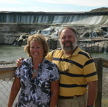
Late in the afternoon, Gary, Patsy, Peggy and I drove to Ryan Dam where Patsy's niece, Bryna, was getting married today. We arrived a bit early so we walked to the observation point to look at the falls. After that, Peg, Patsy and Patsy's sister Maxine (who made the cake for the wedding) were getting the cake put together in the reception hall. After a few trials and tribulations, they got it together and proudly posed for this picture with the cake.

The wedding was held on another small island you
had to get to by walking on a suspended, swinging bridge which was across a small gorge. Not one of my favorite things to do, but I walked across without a problem. The wedding went well with the rush of water in the background and music in the air. The reception followed and, of course, the cake was a hit!!

REMEMBER: You can always click on a picture to enlarge it!!

Sunday, August 24, 2008

Great Falls, Montana, Part I

Today, Peg and I and Patsy and Gary decided to play tourist. We first went to the Lewis & Clark Museum. The Museum is located along the Missouri River in a modern building designed so you can view the river from several places while inside. The journey that Lewis and Clark took was not for the faint of heart! When they got to this point in their sojourn, they were faced with a series of "great falls" they had to portage around (hence the name of the city). There was a depiction of how the men had to haul their boats and gear up the sides of the river to get around the falls. There was a longboat pulling rope in one area to show you how much strength it took to pull one of these boats all day long. It took a lot of strength to get up to a 2 hour "pull" on the meter! Peg and I would not have been the most helpful explorers!!!

After a couple of hours at the Lewis & Clark Museum, we had lunch and then headed for Giant Springs State Park. This was a really pretty place on the banks of the river where a spring pool bubbled up from the earth and flowed over a rock wall into the Missouri River. The water was 50 years old and at 54 degrees. The colors in the spring were a vivid green and could easily be seen through the clear water. 388.8 million gallons of water bubble up from this spring every 24 hours!

Next it was off to Rainbow Falls & Dam. The dam was part of the great falls in the early days of Lewis and Clark. It must have been a magnificent sight back then to see the natural falls created by this river.

In the evening we had dinner at a small restaurant
called Bob's in the Little Bitt Mountains. We enjoyed the company of Denise and Scott, relatives of Gary and Patsy and Patsy's sister Maxine. This area is a popular ski center in the winter.